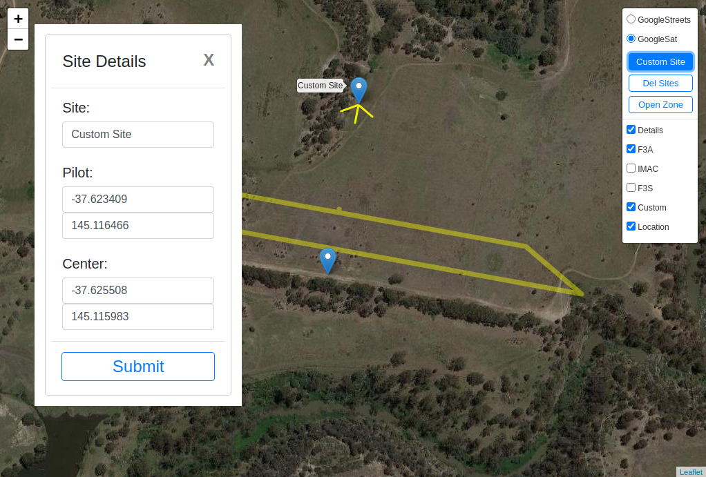
Flight Coach Map (FCMap) is an addon that will assist the pilots in locating a competition box at a site. It takes the site Pilot and Center positions and draws the box angle lines as well as the outline of a box on a map background (Google Maps Satellite and Streets view. Currently supported competition styles are F3A (default), IMAC and F3S.
If you wish to permanently add your site to the FC database please use this FORM.
The map can be used to provide reference points, install box poles or even draw the direction/angle lines.

FCMap displays the sites stored in the dB as well as adding a custom site. The map will work offline as long as the browser retains the map tiles within the cache (more on this later).
Tile caching is done automatically by the browser however the user must maneuver the map and the zoom so all map tiles of interest are displayed. Best is to start from the low zoom overall site view making sure the all tiles/points of interest are visible. Then go one zoom layer down and pan the map again so all points of interest are displayed again. Continue the same way to the highest zoom.
To confirm that the offline data is available, switch off the Internet at the device and attempt to see all points of interest at different zoom levels, down to the highest. The caching has got a limited time span (defined by the map provider); clearing cache will remove the tiles so please confirm the tiles availability before heading to the field.
FCMap supports geolocation (if enabled on the device) that will indicate the user position on the map (red marker) and the accuracy circle. The map will not automatically center on the user position thus allowing reviewing the sites around the World regardless of the current position. When the red marker is clicked, it will display the current accuracy. Geolocation and offline maps combined allow the pilot, judges, competition directors to quickly locate the points of interests on the map.

Currently we have only tested it in Chrome browser yet it is likely that it will work in other browsers too. Geolocation must be enabled both within the Chrome browser and the GPS unit must be switched on if the pilot wishes to see their current location.
Clicking on the FCMap displays the coordinates of the position of the click. The coordinates can be highlighted with the mouse and copied to other applications. The two buttons will copy the coordinates to either Pilot or Center position custom site creation dialog. When the dialog is invoked, there is no need to manually copy the position. This allows for fast creation and review of may site positioning options.


Within the custom site creation dialog the user can enter the name of the site and manually add/correct the positions.

Any site Pilot marker can be clicked and it will reveal the site name and a Save button. The button allows exporting the site details in F3AZone format that can be shared. The map allows loading a site in F3AZone format (Emailedbox.f3a).

